31.03.2026 news
FLEX Fluorescence Workshop 2026 - Highlights & Insights
After over 25 years of development, the Fluorescence Explorer (FLEX) concept is now becoming a reality. The FLEX Fluorescence Workshop 2026 marks the final event of its kind before the satellite’s launch. Here, we’ve compiled a recap of this unique gathering.

FLEX Fluorescence Workshop 2026
Vegetation Fluorescence from Space
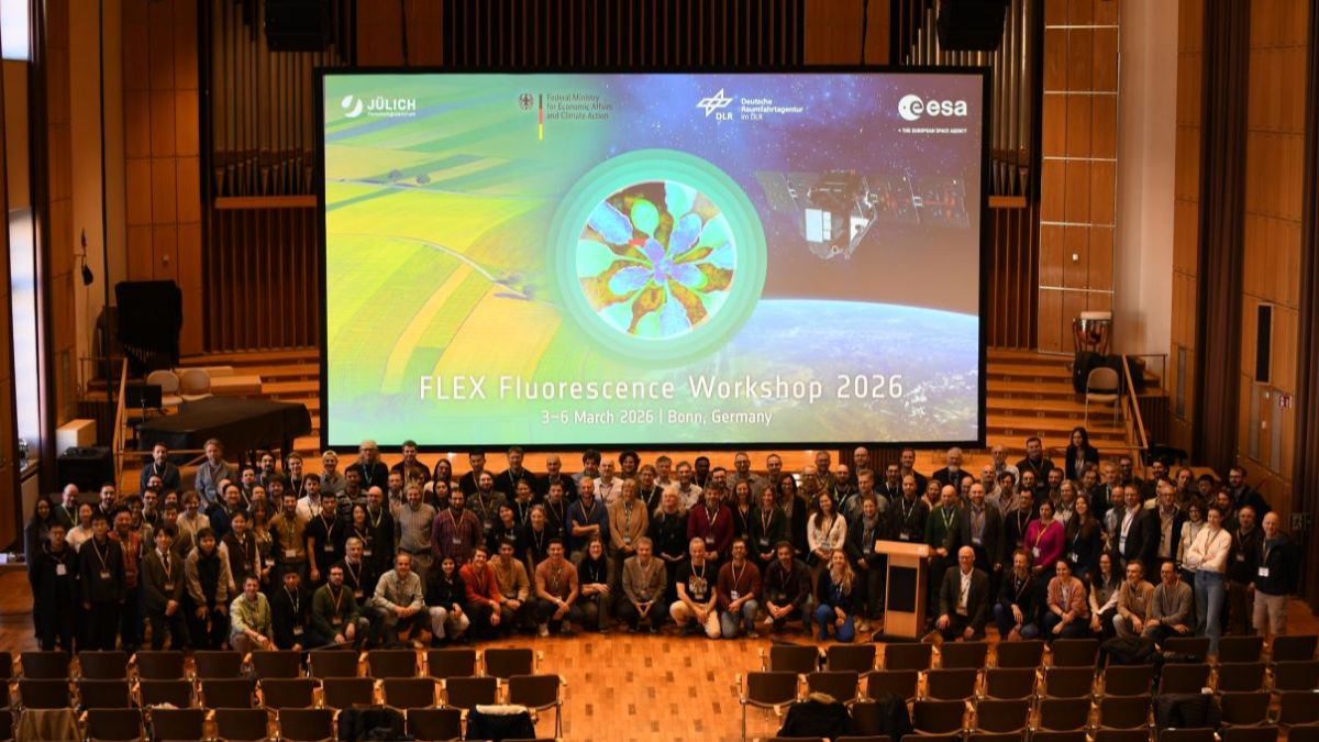
After more than 25 years of development, the concept behind the Fluorescence Explorer (FLEX) is finally becoming reality. Early studies on FLEX date back to the beginning of the 2000s, followed by the first workshop in 2002 and an initial mission proposal in 2005. In 2015, FLEX was selected as part of the Earth Explorer programme and has been in preparation ever since. From March 3rd to 6th 2026, the international research community gathered in Bonn for the final FLEX workshop ahead of the satellite launch, to discuss the current status of the mission and future applications of fluorescence in remote sensing.
The event was organized by the European Space Agency (ESA) together with the German FLEX Project Office at the main building of the University of Bonn. Around 180 international members of the FLEX user community attended.
Workshop Focus
The workshop centered on recent developments in the FLEX mission and the application of solar-induced chlorophyll fluorescence (SIF).
Topics on the agenda included:
- FLEX mission: Getting ready for launch
- Data products and validation strategies
- Exploiting novel indicators for vegetation stress detection
- Understanding the carbon and water cycles using fluorescence data
- FLEX data for studying inland and coastal waters
- Combining multi-scale, multi-mission EO data for closing the temporal and spatial gap
- Concept, protocols and tools for the validation of FLEX products, live demos of the International Network of Sun Induced Chlorophyll fluorescence (INSIF) network and the FLEX collaborative platform (CP).
- Calibration/ Validation activities: Roles and interactions, announcement of opportunity. Introduction to the FLEX confluence page and its use.
The FLEX Mission Goal
The workshop was opened by Uwe Rascher (Forschungszentrum Jülich, University of Bonn), who introduced the significance of vegetation fluorescence for understanding plant processes. Marco Celesti (FLEX Mission Scientist, ESA) then provided an overview of the mission's history.
FLEX mission projectmanager Ralf Bock (ESA) outlined the mission's core objective:FLEX will capture full vegetation fluorescence spectra to quantify the actual photosynthetic activity of terrestrial ecosystems and provide indicators of vegetation health.
In the longer term, this data is expected to deepen our understanding of global ecosystem processes and support applications in a sustainable bioeconomy.
Mission Design
FLEX will operate in tandem with Sentinel-3. While FLEX measures vegetation fluorescence using the FLORIS instrument (Fluorescence Imaging Spectrometer), Sentinel-3 supplies complementary data on atmospheric conditions and earth’s surface properties. The two satellites will be synchronized within a window of 6 to 15 seconds to capture all the parameters needed to determine photosynthetic activity.
The space segment consists of the Vega-C launch vehicle and the compact FLEX satellite, with a wingspan of around 4.8 m and a mass of approximately 400 kg. FLORIS operates across spectral channels in the 500–780 nm range and they achieve a spatial resolution of 300 × 300 m.
Mission operations will be managed from ESA's European Space Operations Centre (ESOC) in Darmstadt, while scientific data processing will be carried out at the European Space Research Institute (ESRIN) in Italy.
Launch Facts
The FLEX mission is currently scheduled for launch in September 2026 (launch window: September to November 2026).
- Launch site & time: Guiana Space Centre, 01:20 UTC (03:20 CEST).
- Orbital altitude: approx. 815 km.
- Average Revisit frequency: 27 days.
- Planned mission duration: 3.5 years.
Following launch, a commissioning phase of roughly three months will be used to test and calibrate the satellite and its instruments in orbit.
For Those Who Missed It
All talks and discussion sessions were livestreamed, making it possible for people to follow along remotely. The recordings remain available on ESA's YouTube channel "EO Open Science".
Brief session summaries
ℹ Below, you’ll find concise summaries of the sessions from the FLEX Fluorescence Workshop 2026 and the FLEX Cal/Val Workshop.
Day 1 [FLEX Fluorescence Workshop]
FLEX Mission : Getting ready for Launch
FLEX Instrument Performance Simulator (FIPS) and Ground Processor Prototype (GPP)
Marc Bouvet (European Space Agency, ESA/ European Space Research and Technology Centre, ESTEC)
Since the vegetation fluorescence signal is significantly weaker than the total measured radiation, instrumental effects must be precisely characterized and corrected. For this purpose, the FLEX Instrument Performance Simulator (FIPS) and the Ground Processor Prototype (GPP) have been developed, enabling the simulation of datasets and testing of Level-2 algorithms. The current software version is being supplemented with parameters from a ground calibration campaign and is intended to be used during the commissioning phase. In the long term, the tools are planned to be made accessible to the user community via the FLEX Collaborative Platform (CP).
FLEX mission products and validation status
Vincet Servera (Magellium)
The Data Innovation and Science Cluster (DISC) is responsible for the development of Level-1C and Level-2 data products. Phase 1 of the project has recently been completed, resulting in a functional prototype of the Level-2 algorithms and initial calibration and quality control concepts. The Level-1C products include calibrated top-of-atmosphere radiances, while the Level-2 products additionally include atmospheric parameters, vegetation fluorescence, and biophysical parameters such as LAI and FAPAR. Initial tests show that many requirements are already being met, but radiometric calibration errors still require further optimization.
The FLEX Collaborative Platform: Enabling Data Processing, Validation, and Scientific Exploitation of FLEX Fluorescence Products
Pedro Pereira Goncalves (Terradue)
The FLEX Collaborative Platform (CP) is intended to provide the user community with central access to data and analysis tools. Various user roles are planned, ranging from simple data exploration to scientific evaluation and active algorithm development, for example in Python. The platform is based on open-source components and includes data catalogs, APIs, a geo-browser, and a GitLab environment. It is currently still in the development phase.
Data Products and Validation Strategies I.
The Atmospheric Correction Processor of the FLEX Sentinel-3 Tandem Space Mission
Pekka Kolkmonen (Finish Meteorological Institute, FMI)
The Finnish Meteorological Institute (FMI) is developing the atmospheric correction processor for FLEX, which combines FLORIS data with Sentinel-3 measurements. The processing chain includes cloud screening, determination of aerosol properties and water vapor content using SLSTR, and the actual atmospheric correction. Uncertainties from instrumental and atmospheric sources are explicitly modeled. Tests with simulated scenes show good results, especially over vegetated areas.
SIF Full-Spectrum Retrieval in the Framework of the FLEX Mission
Sergio Cogliati (University Milano-Bicocca)
The Level-2B module derives the full fluorescence spectrum in the range of approximately 670 to 780 nm from FLEX data, including metrics such as fluorescence intensity in the oxygen absorption bands and spectrally integrated fluorescence. The basis is a forward model that is adapted to measured spectra. Tests show good results, especially for the O2-A band. The O2-B band remains more challenging due to stronger noise influences. The algorithm has also been adapted for ground-based and UAV-based measurements to facilitate later validation of FLEX data.
Photosynthesis data products of FLEX
Christiaan van der Tol (University of Twente)
At the end of the FLEX processing chain, there are eleven photosynthesis and vegetation products, including LAI, chlorophyll and carotenoid content, APAR, as well as parameters such as fluorescence quantum efficiency (FQE), electron transport rate (ETR), and non-photochemical quenching (NPQ). They are calculated using machine learning, spectral fitting, and physiological modeling. For each product, in addition to the estimated value, uncertainties and quality flags are also provided. While some products already deliver reliable results, others, particularly NPQ modeling, still require further development.
Cal/Val Activities for the FLEX-Mission: Approach and Current Status
Roberto Colombo (University Milano-Bicocca)
The validation strategy combines direct comparisons with ground measurements, radiative transfer modeling, and cross-checking with other satellite datasets. The 27-day revisit time and 300 m spatial resolution pose particular challenges, requiring careful planning of field campaigns. Numerous measurement sites are used worldwide in different vegetation ecosystems. Automated Cal/Val tools, which are to be integrated into the FLEX Collaborative Platform (CP), enable the systematic comparison of FLEX data with reference measurements from field and aircraft campaigns.
Point-to-pixel upscaling and uncertainty in FLEX L2 reflectance validation
Pieter De Vis (National Physical Laboratory)
Since a FLEX pixel covers about 300 x 300 m, which is significantly larger than the area captured by ground instruments, a spatial discrepancy arises during validation. Automatic measurement networks such as INSITU and HYPERNETS stations provide continuous reference data that are temporally, spectrally, and geometrically corrected. High-resolution data from Sentinel-2 enable spatial upscaling; the Spatial Homogeneity Index (SHI) serves as a quality measure. However, in heterogeneous landscapes, spatial variability remains a significant source of uncertainty.
Bridging Observation Scales for the Calibration and Validation of FLEX SIF Products
Giulia Tagliabue (University Milano-Bicocca)
This presentation also addresses the scale discrepancy between ground measurements and satellite pixels. Tower, drone, and aircraft measurements (HyPlant) are combined in two validation approaches: the single-point strategy with one measurement point per pixel and the multi-point strategy with several points for better capture of spatial variability. Transfer functions such as NIRv improve the agreement between scales, especially in the single-point strategy. Optimized drone flight patterns provided reliable comparison results.
Validation of FLEX Level-2 Biophysical Product Approaches and Current Status
Bastian Siegmann (Juelich Research Centre, FZJ)
Nine biophysical products are being validated, including LAI, fAPAR, chlorophyll and carotenoid content, as well as photosynthesis-related parameters such as FQE, ETR, or Fesc. The validation strategy combines three approaches: direct comparison with ground measurements, inversion of the SCOPE radiative transfer model, and cross-checking with other satellite products. For photosynthesis-related parameters, a two-step scaling approach is applied, where leaf measurements are first upscaled to the canopy level and then to the FLEX pixel size.
Data Products and Validation Strategies II
FLEXvalGER – in situ, UAV, Airborne & Satellite Validation of FLEX L1C-L2C Products in Germany
Juliane Bendig (Juelich Research Centre, FZJ)
The FLEXvalGER project, which is still in the application stage, plans a nationwide network of arable and forest sites with measurements at all scales, from leaf to canopy to satellite pixel. In addition to classical vegetation parameters, there is a special focus on the validation of photosynthesis-related products such as FQE, ETR, or Fesc. Aircraft and satellite data from other missions are to be spectrally and spatially adapted to FLEX, and uncertainties are to be systematically recorded.
Validation Strategies for FLEX Level-2-Products: The SpaFLEX Multi-Scale Protocol and Application in Doñana National Park
Marcos Jiménez (National Institute of Aerospace Technology, INTA)
The project, coordinated by INTA and the University of Valencia, pursues a bottom-up validation approach that scales leaf, canopy, UAV, and aircraft measurements step-by-step to the FLEX pixel size. Special calibration protocols ensure the comparability of the instruments used. A field campaign in Doñana National Park provided initial results: spatial aggregation combined with systematic uncertainty analysis enables reliable reference data, especially for the O2-A band.
FLORA – FLEX Leaf Observation and Retrieval via Hybrid Approaches: A Multi-Sensor Framework for Calibration and Validation of FLEX L2B/L2C Products
Carlos Camino (University of Wageningen)
FLORA pursues a multi-stage, cross-scale validation approach for parameters such as leaf chlorophyll, LAI, FAPAR, and SIF products. Field measurements, UAV, aircraft, and satellite data, including Sentinel-2 and, if possible, PRISMA or EnMAP, are combined. Planned sites include ICOS areas in the Netherlands and Italy; radiative transfer models will support the derivation of plant traits from spectral data. The actual validation campaigns are planned from 2027 onwards.
Upscaling Photosynthetic Function for Representative Terrestrial Ecosystems in the USA
Petya Campbell (University Maryland Baltimore County, UMBC/ National Aeronautics and Space Administration, NASA)
The project investigates daily and seasonal dynamics of fluorescence and photosynthesis in North American ecosystems—initially tundra and boreal forests in Alaska, with a perspective on grasslands, deciduous forests, and tropical forests. Leaf and canopy measurements are combined using PAM, FLoX, and PRISMA satellite data and scaled to satellite level using models such as SCOPE. Initial results show clear differences between ecosystem types; ETR maps based on PRISMA data have already been derived.
Integrating tower-based dual-geometry hyperspectral system and drone-based hyperspectral imaging system for calibration and validation of the FLEX mission across multiple ecosystems in South Korea
Youngryel Ryu (Seoul National University)
A specially developed tower system enables simultaneous hemispherical and directional measurements of reflectance and fluorescence, providing continuous time series over entire vegetation periods. Complementary drone recordings bridge the scale gap between tower and FLEX pixel size. Additionally, it was shown that SIF can be calculated and mapped from medium-resolution hyperspectral data using spectral fitting methods.
INSIF, International Network of Sun-Induced Chlorophyll Fluorescence
Tommaso Julitta (JB Hyperspectral Devices)
The FloX instrument measures incoming and reflected radiation simultaneously, enabling continuous long-term measurements of reflectance, vegetation indices, and SIF. Within the framework of INSIF, these data are made usable for FLEX validation: processing processes are standardized, uncertainties quantified, and an online portal with a central database is being established. A mobile calibration system is intended to ensure the comparability of the instruments. The network currently comprises ten instruments and is to be further expanded.
Considerations of the use of in situ spectroscopy measurements for FLEX data validation
Alexander Damm (University of Zurich)
The presentation addresses the challenges of ground-based validation, with a focus on forest sites. In addition to FloX measurements, GNSS-based canopy moisture and thermal data are used. A central issue is the quality assurance of ground measurements: shading and changing light conditions in forests can significantly affect reflectance and derived indices such as NDVI, PRI, or LAI. It was also noted that higher-level products such as GPP or vegetation water content are not always directly comparable with optical satellite data.
Day 2 [FLEX Fluorescence Workshop]
Exploiting Novel Indicators for Vegetation Stress detection
SIF to Measure Actual Photosynthesis and Vegetations Stress – Lessons Learned from 20 Years of Research in Preparation of the FLEX Satellite Mission
Uwe Rascher (Juelich Research Centre, FZJ)
The presentation discusses the use of sun-induced fluorescence (SIF) for detecting vegetation stress. SIF shows earlier reactions than classical indices, especially during drought. It is also sensitive to extreme temperatures, although the underlying mechanisms are not yet fully understood. Challenges exist in scaling and in detecting diseases and nutrient deficiencies. Overall, SIF is promising but should be combined with other remote sensing methods.
The Role of Species-Specific Physiology and Diurnal Phase in Interpreting SIF
Sebastian Wieneke (University of Leipzig)
The presentation highlights the complex relationship between SIF and photosynthesis based on measurements from two tree species. This relationship is not linear but varies depending on the time of day, season, and stress state. Red fluorescence is more strongly associated with physiological processes than far-red fluorescence. Different species respond differently to stress, complicating interpretation. For remote sensing, this means that single satellite overpasses are often insufficient, as important dynamics may be missed. A combination of different sensors and measurement approaches is therefore recommended.
Activities and Outcomes of the FLEX-ITA project airborne and ground campaigns
Karolina Sakowska (National Research Council, CNR)
The presentation introduces the FLEX-ITA project in support of the FLEX mission. Aircraft and ground measurements show good agreement of SIF data. In experiments with corn and tomatoes, water stress led to decreased photosynthesis and fluorescence, while irrigation resulted in recovery. However, differences between plants and structural effects complicate the evaluation.
Exploring the Nonlinear Relationship Between Photosynthesis and Chlorophyll Fluorescence Dynamics for Early Stress Detection
MaPilar Cendrero-Mateo (University of Valencia)
The presentation shows that the relationship between SIF and photosynthesis is nonlinear, making linear models unsuitable. Nonlinear models provide better results, with fluorescence efficiency and the red-edge region providing important information. Environmental conditions such as light and stress significantly influence the dynamics of photosynthesis. Sensitive stress indicators include an increase in non-photochemical quenching (NPQ) and a decrease in fluorescence. The analysis of temporal changes is crucial for early stress detection.
Tracing Changes is Subsurface Water Storage Through a Novel Satellite-Based Time-Series of Far-Red Solar-Induced Fluorescence Quantum Efficiency
David Herrera (Juelich Research Centre, FZJ)
The project investigates whether SIF-based fluorescence efficiency (ΦF) can detect changes in soil water content from a satellite perspective. Using daily satellite data over Germany, it was found that ΦF is closely related to water availability in the root zone and responds to drought stress with a delay of about two days. Classical vegetation indices such as NDVI or NIRv do not show these short-term changes. Land surface temperature also reacts similarly sensitively. Overall, the study underscores the potential of SIF for early detection of drought stress at the ecosystem level.
Sun-induced fluorescence derived canopy level effects of elevated CO2 and Cercospora leaf spot on photosynthesis in field-grown sugar beet
Deepthi Konche (Juelich Research Centre, FZJ)
The project investigates how SIF can detect diseases in sugar beets (Cercospora Leaf Spot). The disease affects both the structure of the plants and their photosynthesis. It was found that SIF responds primarily to structural changes. Indices and SIF detect the disease early, while fluorescence yields reflect internal (physiological) processes. Under stress, SIF and PSII efficiency behave oppositely, especially in SIF687. Overall, SIF has great potential to detect diseases, but the exact relationships need to be further explored.
Understanding the Carbon and Water Cycles using Fluorescence Data.
Monitoring photosynthetic quantum yield through non-photochemical quenching, from laboratory to field: integrating canopy fluorescence reflectance and GPP
Adrian Moncholi-Estornell (University of Valencia)
The presentation shows that spectral data and the partial least squares regression (PLSR) method can be used to identify spectral features and wavelength ranges associated with photosynthesis. To be used at the ecosystem level, spectral variability was investigated in relation to gross primary production (GPP) and non-photochemical quenching (NPQ). Signals in the green and red-edge regions are particularly important. These patterns occur both in the laboratory and in the field and remain similar even after corrections. Under stress, clear reactions can be observed that reflect short-term changes in photosynthesis. Overall, the method is well suited as an initial analysis tool but needs further improvement for more precise applications.
Beyond Photosystem II: How Photosystem I Dynamics Regulate Electron Transport in a Rice Paddy
Huaize Feng (Seoul National University)
Huaize Feng shows that processes in Photosystem I (PSI) play an important role in understanding photosynthesis and have often been underestimated. An extended model (BESS-JB) can accurately represent photosynthesis at the ecosystem level. It shows that PSI and PSII work in balance and that energy is shifted between them, affecting efficiency. Heat dissipation (NPQ) in PSI is also activated earlier and more strongly than in PSII. Importantly, a significant portion of the SIF signal originates from PSI, which must be considered in interpretation.
Shared light absorption rather than physiological coupling explains the apparent SIF-GPP relationship at canopy scale across diverse ecosystems
Jeongho Lee (Seoul National University)
The presentation shows that the relationship between SIF and GPP is mainly due to the fact that both depend on the same light absorption. Plant structure (e.g., light distribution in the canopy) strongly influences the SIF signal. When this influence is taken into account, SIF can still provide information about the physiological state of plants. Therefore, SIF is more than just a simple substitute for GPP.
Atmospheric dryness effects on canopy chlorophyll fluorescence and Gross Primary Production (GPP) in a deciduous forest during heat waves
Zhaohui Li (Paris-Saclay University)
The presentation shows that under dry air (stress), the relationship between SIF and photosynthesis (GPP) weakens. Instead, active fluorescence better reflects photosynthesis. Under stress, SIF is less sensitive, while active measurements show changes more clearly.
The SIF Model Intercomparison Project (SIF-MIP Phase 2)
Haoran Liu (Imperial College London)
Current SIF models still show large differences in their results, mainly due to different model assumptions and parameters. By comparing with measurements (e.g., from towers or satellites), the models can be improved. Overall, SIF is important for understanding carbon cycles, but the models need to become more accurate.
Analyzing the global role or TROPOMI-derived SIF and Sentinel-3 fundamental vegetation traits as proxy predictors in GPP models
Pablo Reyes Munoz (University of Valencia)
The presentation shows that satellite-based SIF data can be well used to estimate gross primary production (GPP). Especially in combination with weather data, SIF data provide better and more stable models. Additionally, SIF helps to understand which factors (e.g., climate or vegetation) influence photosynthesis. In the future, these methods are to be further improved with new, more accurate satellite data (e.g., FLEX).
Disentangeling the Relationship Between Solar-Induced Fluorescence and Photosynthesis in Scots Pine in Response to Drought
Ingo Ensminger (University of Toronto)
The project investigates whether SIF can be used to detect drought stress in pines. For this purpose, irrigated and non-irrigated areas in a forest in Switzerland were compared. The results show that SIF A is sensitive to drought stress and is higher in irrigated areas. SIF B, on the other hand, was significantly less sensitive and showed differences mainly under particularly dry and hot conditions. Overall, the study suggests that some SIF signals reflect drought stress better than others.
A Land-Biogeochemical Reanalysis to Rocncile Earth Observations, Benchmark Models and Advance Earth Science Understanding and Prediction
Nicholas Parazoo (California Institute of Technology, Caltech)
The presentation introduces a large modeling project that jointly evaluates carbon, water, and energy fluxes. Satellite data and models are combined to fill gaps in measurements and better understand Earth system processes. The goal is to reduce uncertainties in the carbon cycle and climate predictions. SIF data also play an important role in this, as they can help improve and make models more realistic.
FLEX data for studying Inland and Coastal Waters
FLEX mission data for inland water research: Insights from studies in Swiss lakes
Alexander Damm (University of Zurich)
The presentation shows that FLEX can also be useful for research on lakes and coastal waters. Due to the high spectral resolution, processes in the water can be studied more precisely, such as fluorescence, chlorophyll, and the composition of phytoplankton. It is particularly important that FLEX offers new possibilities for determining chlorophyll-a and distinguishing different phytoplankton species. At the same time, it was emphasized that the temporal and spatial resolution for water bodies remains a limitation.
The PHY2FLEX project: PHYsiology and species mapping a global water PHYTOplankton from FLEX-Sentinel 3 synergy - Focus on the top-of-atmosphere hyperspectral signature including the sun-induced fluorescence
Tristan Harmel (Magellium)
The presentation introduces the PHY2FLEX project. The aim is to better observe water bodies using FLEX and Sentinel-3 together. The focus is on phytoplankton and how well fluorescence can be used to detect their condition and activity. The results show that FLEX, with its high spectral resolution, provides more information and offers new possibilities for water research.
Aquatic product validation of the Fluorescence Explorer (FLEX) mission (AquaValiX)
Anna Görlitz (University of Freiburg)
The goal of the AquaValiX project is to test and further develop FLEX data for water bodies (lakes, coasts, oceans). For this purpose, satellite data are compared with on-site measurements to improve the results. Additionally, new products (e.g., on water quality or chlorophyll) are to be developed. In the long term, a permanent measuring station for inland waters is planned.
Thinking beyond state-of-art: novel applications for FLEX data
Development and validation of an approach to quantify maximum photosynthetic capacity of terrestrial plants from FLEX mission products
Jennifer Johnson (University of Kansas)
The presentation shows that the maximum photosynthetic capacity of plants could be better determined using FLEX data. For this purpose, a new model is to be used that takes into account not only Rubisco but also Cytochrome b6f. This is important because it allows a more accurate description of the relationship between photosynthesis and fluorescence. In the long term, a new product is to be created that allows important processes of photosynthesis to be derived from satellite data.
Linking Solar-Induced chlorophyll Fluorescence to Biogenic Volatile Organic Compounds Emissions in low Arctic Tundra: A Field Spectroscopy approach
Frederico Grillini (University of Copenhagen)
The presentation investigates whether SIF and other spectral indices can be used to estimate BVOC emissions from plants. For this purpose, field measurements with spectrometers and air samples were combined in the Arctic tundra in Greenland. The results show that SIF can be a useful indicator of emissions for some groups of substances, together with indices such as PRI or EVI. At the same time, SIF alone is not sufficient and must be considered together with environmental factors such as temperature or soil moisture.
Day 3 [FLEX Fluorescence Workshop]
Recent Advances in Modeling activities
Cloud-Operational Sentinel-3 Vegetation Trait Retrievals to Support FLEX L2/L3/L4 Products
Jochen Verrelst (University of Valencia)
Researchers at the University of Valencia have developed three model generations for deriving vegetation parameters from Sentinel-3 data, including chlorophyll content and leaf area index. The basis is Gaussian Process Regression, which provides both estimates and uncertainties. The latest version combines epistemic and aleatoric uncertainties for the first time. The models are available in the open-source package pyEOGPR. The goal is to support the FLEX mission in global fluorescence mapping.
AMLEC-2: Atmospheric Radiative Transfer Emulation Challenge (FLEX Mission Edition)
Jorge Vicent Servera (University of Valencia)
Radiative transfer models are central to remote sensing but are very computationally intensive. Therefore, it is being investigated whether machine learning-based emulators can replace them. In a first project, eight models were compared. GP models performed well with small datasets, while neural networks performed better with large datasets. A second edition is planned for 2026. The focus will then also be on uncertainties and efficiency.
Physics-based emulation of at-sensor radiances as a tool for novel SIF retrieval schemes
Miguel Pato (German Aerospace Center, DLR)
An emulator replaces complex radiative transfer simulations for SIF in the O2-A band. Trained on millions of spectra, it provides fast and precise results. Surprisingly, simple polynomials performed best. Additionally, differences of up to 20% were found between MODTRAN and libRadtran, indicating relevant uncertainties for SIF retrievals. The approach is significantly more efficient than classical models.
SLOPE: A radiative transfer model for leaves incorporating fluorescence
Stefan Maier (maitec)
As an alternative to existing leaf radiative transfer models such as PROSPECT, Stefan Meyer presented the model "Stochastic model for Leaf Optical Properties Extended for fluorescence" (SLOPE), a physically based, multi-layer leaf model that simulates reflectance, transmission, and chlorophyll fluorescence. A key difference from previous approaches is the explicit consideration of the spatial distribution of chloroplasts in the leaf: since chlorophyll is not homogeneously distributed but concentrated in chloroplasts, and these can even move depending on light conditions, this has measurable effects on the fluorescence signal of up to 20-30% in the red spectral range. The model uses easily accessible input parameters such as pigment concentrations and is to be made available as an open-source Python package on GitHub soon.
JULES-SIF V1.0
Tristan Quaife (University of Reading)
Researchers at the UK National Centre for Earth Observation have extended the land surface model JULES, which is used, among other things, in the UK climate model and weather forecasting, with a physically consistent SIF module. The SIF calculation uses the same radiative transfer physics (Sellers two-stream model) as the main model. This allows deviations from satellite data such as TROPOMI to be directly attributed to model errors. An example from the Pantanal showed that missing surface runoff led to an underestimation of fluorescence. The code is publicly available. In the future, leaf differences and the hotspot effect are to be taken into account.
Terrestrial Carbon Community Assimilation System
Thomas Kaminski (The Inversion Lab)
The Terrestrial Carbon Community Assimilation System (TCCAS) combines a process model with satellite data (including TROPOMI-SIF, FAPAR, VOD, and soil moisture) to capture carbon fluxes. Through data assimilation, model parameters are adjusted to best reproduce all datasets simultaneously. Validations with Eddy-Covariance data show significantly improved GPP estimates. Land use changes could also be realistically simulated. The uncertainty of predictions is reduced. The open system is already being tested with TROPOMI and is planned for FLEX.
Combining multi-scale, multi-mission EO data for closing the temporal and spatial gap
Retrievals of Solar Induced Chlorophyll Fluorescence from Chinese Satellites
Zhaoying Zhang (Nanjing University)
Researchers at Nanjing University have derived SIF from the Chinese Goumang satellite for the first time. This satellite has a hyperspectral sensor specifically designed for fluorescence, similar to the FLEX mission. Using an SVD method in the 743-758 nm range, a global SIF product was generated. It shows realistic seasonal and spatial patterns and a higher detail resolution than TROPOMI. Validation with aircraft, drone, and ground data confirmed the results. The data are publicly available and are to be further expanded.
Diurnal variations in red Solar-Induced chlorophyll fluorescence retrieved from the TEMPO geostationary mission
Zhaoying Zhang (Nanjing University)
The geostationary TEMPO satellite enables hourly SIF measurements for the first time, allowing the analysis of daily patterns of photosynthesis. Based on this, red SIF (660-685 nm) was derived globally for the first time. This spectral range is theoretically more closely related to photosynthesis but is more difficult to measure. The results show clear, vegetation-type-dependent daily patterns. There is also a high agreement with GPP data (R² ≈ 0.89). Artifacts and individual deviations are currently still being investigated.
DESIS and ENMAP Imaging Spectoscropy Data in Support of the FLEX Mission
Emiliano Carmona (German Aerospace Center, DLR)
The German Aerospace Center (DLR) presented the hyperspectral sensors DESIS and EnMAP as complements to the FLEX mission. Both provide high-resolution data at 30 m, significantly finer than the 300 m of FLEX. This makes them particularly suitable for heterogeneous landscapes. In addition to SIF, vegetation parameters such as pigment content can also be derived. SIF in the O2-A band has already been successfully obtained from DESIS data. These measurements were validated with HyPlant and are unique in this resolution so far.
Bridging the Gap to the FLEX Era: A Cloud-Computing Framework for 300 m Global SIF Retrieval from Sentinel-3 and TROPOSIF
uxin Zhang (University of Valencia)
The presentation introduces a global SIF product with 300 m resolution, calculated from Sentinel-3 and TROPOMI data using a random forest model. The goal is to represent SIF at a much finer resolution and thus better capture landscapes such as irrigated fields. Overall, the results agree well with ground-based measurements and TROPOMI and show less noise. Seasonal patterns and differences between dry and irrigated areas can be particularly well identified. The product is intended to provide an important basis for future work with FLEX data.
Can extracting fluorescence efficiency from individual TROPOMI observations result in a better estimation of drought stress than gridded products
Qiqi Deng (Max Planck Institute for Biogeochemistry)
The study investigated whether drought stress can be better detected with SIF or with fluorescence efficiency. For this purpose, SIF was combined with light and vegetation information before spatial aggregation. Initial results show partially similar patterns to other stress indicators. However, the results vary depending on the dataset and methodology. Parameters such as PAR, NIRv, and the SIF product used are particularly decisive. Overall, the approach is promising but still preliminary.
A roadmap towards estimating the diurnal dynamics of terrestrial ecosystem productivity with the help of FLEX
Gregory Duveiller (Max Planck Institute for Biogeochemistry)
The presentation shows that diurnal patterns of SIF are crucial for understanding short-term stress responses in vegetation. FLEX provides precise measurements for this but is limited by the low revisit rate. For comprehensive monitoring, a combination with other satellites is therefore proposed. These include TROPOMI, OCO-3, and geostationary systems. The goal is to capture continuous diurnal dynamics. This allows processes to be interpreted much better.
Day 3 [FLEX CAL/VAL Workshop]
Short Discussion Round
The discussion made it clear that FLEX should initially focus on delivering reliable measurements and Level-2 products. Advanced products such as ETR or GPP are intended for later stages of development. For this, standardized validation approaches, clear methods, and shared reference data are required. Additionally, the terms related to SIF are currently inconsistent and should be unified. It was also emphasized that validation cannot only be done at the leaf level, as leaves and canopies differ significantly. Therefore, good sampling strategies, common protocols, and comparable measuring instruments are important. Another topic was diurnal dynamics: while FLEX provides precise data, it does not do so frequently enough. Hence, a combination with other missions and measurement systems is seen as necessary. The key is to meaningfully integrate and utilize the various datasets.
Concept, protocols, results and tools for the validation of FLEX products
Preparing for the FLEX Validation Activies
Marco Celesti (European Space Agency, ESA/ European Space Research and Technology Centre, ESTEC)
The introduction emphasized that FLEX validation is based on many years of preparatory work. There are already initial protocols, strategies, and tools that are now to be further developed together with the community. The aim of the following sessions is to present these approaches and gather feedback. Roles, expectations, and data exchange are also to be more clearly defined. Additionally, the next topics were introduced, including validation protocols, measurement networks, and the FLEX Collaborative Platform (CP). A first virtual workshop is planned for June. There, projects are to be coordinated, gaps identified, and common standards further developed.
Concept, protocols and tools for validation of FLEX products
Roberto Colombo (University Milano-Bicocca)
The presentation provides an overview of the FLEX validation strategy. The goal is to compare satellite data with ground measurements, models, and other satellites. It is important that the measurement sites spatially match the FLEX pixel and are temporally aligned with the overpass. Various approaches are used, such as point measurements, drone, and aircraft data. A central point is also the consideration of uncertainties in all comparisons. Overall, it became clear that successful validation only works with common protocols and close collaboration.
The FRM4FLUO Project
Tomasso Julitta (JB Hyperspectral Devices)
The FRM4FLUO project develops measurement protocols and guidelines for the validation of FLEX products. The aim is to enable reliable and comparable reference measurements from the laboratory to the field. It is being investigated how instruments are correctly calibrated, set up, and how the data are processed. Even small errors can significantly affect fluorescence measurements. Additionally, it is about transferring point measurements to larger areas to compare them with FLEX data. Overall, the presentation shows that standardized protocols, quality controls, and a precise description of uncertainties are crucial.
L2-Validation of Fluorescence Products
Roberto Colombo (University Milano-Bicocca)
The presentation shows how the validation of FLEX products is to be implemented in practice. It is important to know the respective mission requirements, as different products have different accuracy targets. For fluorescence, the target is, for example, less than 10% deviation. Various methods have been tested, including individual measurements, transfer functions, and multi-point approaches. An important approach is to transfer point measurements with Sentinel-2 data and indices such as NIRv to larger areas. The results show that this improves the agreement with satellite data. At the same time, it becomes clear that there is no perfect method. Clear protocols, uncertainty specifications, and well-documented measurements are crucial.
International Network of Sun Induced Chlorophyll fluorescence (INSIF):ToR, user interface, data upload, access and analysis
International Network of Sun Induced Chlorophyll Fluorescence (INSIF): ToR, user interface, data upload, access and analysis I
Tomasso Julitta (JB Hyperspectral Devices)
The presentation introduced the INSIF/ FLoX network, which collects fluorescence data from various sites and makes it accessible to the community. The aim is both the validation of FLEX and a better understanding of ecosystems. A central element is the mobile calibration unit MOX. This allows instruments to be recalibrated directly in the field to improve the comparability of measurements. The calibration takes about 30 minutes and is also suitable for UAV or aircraft systems. The data are uploaded automatically or manually, then processed and supplemented with metadata and uncertainties. It is important that sufficient information about the site and measurement setup is provided. It remains open how many MOX systems are needed and how their use will be organized. Probably, important sites will have to be prioritized.
FLEX Collaborative Platform: ToR, user interface, data upload, access and analysis
FLEX Collaborative Platform
Livedemonstration von Simone Vaccari (Terradue)
At the end, the FLEX Collaborative Platform was presented. It is intended to serve as a common workspace where data, code, and results can be shared and edited directly online. The platform includes various components, such as a data catalog, a geo-browser, and integrated tools like Jupyter, VS Code, and QGIS. Own data can also be uploaded, analyzed, and visualized. This was demonstrated using Sentinel-2 and simulated FLEX data. It is important that the platform is open, well-documented, and extensible. Additionally, training and webinars for users are planned. The discussion included topics such as computing resources, data access via APIs, and the integration of additional datasets. Overall, the platform is intended to become a central tool for the joint evaluation and validation of FLEX data.
Day 4 [FLEX CAL/VAL Workshop]
FLEX-Mission: Scientific Community Prepares for Satellite Launch
FLEX-Mission: Scientific Community Prepares for Satellite Launch
The FLEX mission is entering its crucial preparation phase. During a multi-day international workshop, questions regarding calibration and validation strategy (Cal/Val), data infrastructure, and scientific collaboration between internal and external research teams were discussed in detail.
High Participation in Cal/Val Coordination
The response from the scientific community is remarkable. In the first submission round, 21 project proposals for validation activities were submitted and confirmed, with seven more from a second round still under technical review. These numbers highlight the great interest in the mission but also pose a real challenge for the organizers: coordinating so many parallel activities requires clear structures. The ESA is relying on a collaborative platform based on Confluence as a central tool, which is intended to consolidate mission updates, data exchange, and team communication in one place. The DISC team is responsible for the content-related validation of products and the optimization of algorithms. External research groups contribute measurement data, scientific feedback, and independent quality assessments. Additionally, tools for overflight planning based on Sentinel-3A orbital parameters are to be developed to provide practical assistance to field teams in coordinating their measurement campaigns.
Validation at All Product Levels
A point that repeatedly came up in the expert discussions was the question of how far validation should go. The answer was clear: it should not be limited to fluorescence products and biophysical parameters. Even the Level-1C radiance data must be carefully checked, as errors or systematic deviations at this level can propagate through all downstream products and significantly distort scientific conclusions. At the same time, the potential of data fusion with complementary satellite missions was emphasized. Combining FLEX observations with data from OCO-2, OCO-3, and the Sentinel missions opens up opportunities for cross-validation and synergistic evaluations, helping to place the new data in a broader scientific context.
Interdisciplinarity as a Strength
The final plenary discussion once again highlighted what distinguishes the FLEX community: the close collaboration between very different disciplines. Fields such as atmospheric research, plant physiology, radiative transfer modeling, and satellite-based remote sensing are necessary to robustly validate and interpret the mission data. At the same time, it was suggested to form topic-specific subgroups to address certain questions more specifically.